
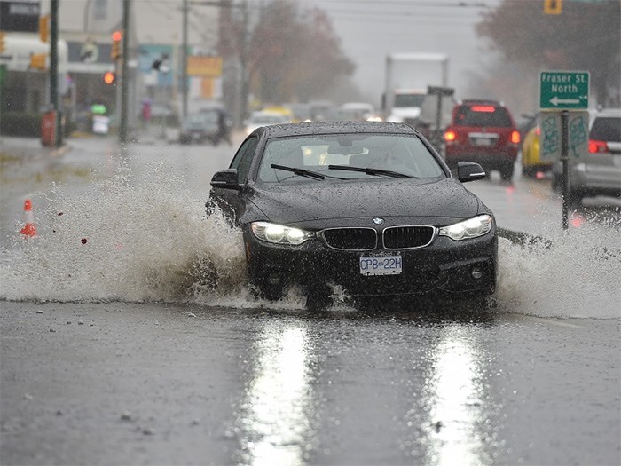
 Torrential rainfall Sunday afternoon led to pooling and localized flooding in some areas. Photo Dan Toulgoet
Despite a deluge of rain over the weekend, the month of November has been a dry one.
“Believe it or not, it’s been drier than normal,” said Environment Canada meteorologist Matt MacDonald, adding that the region experienced an unusual seven-day stretch of dry weather Nov. 3 to 10.
“Of anything, that’s been the exceptional story this month — that beautiful week of weather we saw.”
Mother Nature made up for it over the weekend, dumping more than 70 millimetres of rain on parts of Metro Vancouver between Saturday evening and Monday morning. Rainfall amounts varied across the Lower Mainland — the weather station at Vancouver Harbour Centre recorded 74 mm while the airport reported 30.3 mm during the same time period.
The airport typically sees around 185.8 mm of rain in the month of November. So far this month, it’s recorded 91.8 mm.
“I think what was truly exceptional about (Sunday) was the rainfall intensity,” MacDonald said, adding that the rainfall peaked between noon and 3 p.m.
During that time, Vancouver Harbour Centre recorded 10.5 mm of rain in one hour.
“Which is truly torrential rainfall,” he said, explaining rain that intense is usually only seen in Vancouver about once every two years.
“What happens when it rains that hard is that it surpasses infrastructure’s capacity to flush that out so storm drains end up getting clogged, especially those that have leaves at the entrance. So, we did see a lot of water pooling and localized flooding,” MacDonald said.
That wasn’t the end of the rain this week.
“Tomorrow (Nov. 21) is probably going to be the best day of the week, we’ll probably have a dry morning and maybe beginning of the afternoon but then the next storm is already on our doorstep and it’s going to be a couple of quite soggy days,” he said, adding that steady rain is expected from Tuesday afternoon through to Thursday afternoon.
“We could expect anywhere from 40 to 100 millimetres, depending on where you are over that next two-day period.”
And what can Vancouverites expect this winter, after last year’s seemingly endless weeks of cold temperatures and snowy streets?
“Last winter was truly exceptional,” MacDonald said. “It was record-breaking in many regards.”
He said two factors came together and resulted in last winter’s run of unusually cold and snowy weather — a strong La Niña front which led to a colder than normal water in the equatorial Pacific combined with a cold “blob” of water closer to home off the West Coast.
“With those two masses of ocean water that were significantly colder than normal, that definitely helped deliver the really cold and snowy winter that we had last winter,” he said.
MacDonald said a weak La Niña is expected this coming winter, so the cold in the waters along the equator won’t be as pronounced this year, and the frigid “blob” of water off the West Coast is gone.
He said La Niña typically brings colder than normal weather and most La Niñas have delivered snowier than normal conditions.
“I’d really like to just take the time to clarify and emphasize, seasonal forecasts need to be taken with a grain of salt,” MacDonald said, adding that some weather services can do a disservice by pinpointing major storms or snowfalls weeks in advance.
“We can’t tell you that,” he said. “Primarily our skill is in the temperature forecast.”
There is an increased likelihood of colder than normal weather in the coming winter, but the difference overall could be just a half to one degree on average.
And while last winter seemed like the winter to end all winters, it was the 10th coldest winter on record, dating back to the 1930s, and the 18th snowiest.
Vancouver airport recorded 64 centimetres of snow last winter while the snowiest season on record was the winter of 1970-’71, which saw 169 cm of snow.
The City of Vancouver earlier this month announced changes to its snow response plan, based on lessons learned last winter, including: expanded coverage locations, increased salt storage and prioritized service response times. The city has also added new vehicles to its fleet that are adaptable for use in all seasons and will be able to access neighbourhoods and lanes more easily to support garbage and green bin collection.
jkerr@vancourier.com


