
Hurricane Ernesto is expected to bring heavy surf to coastal communities in Nova Scotia starting late Saturday, says the Canadian Hurricane Centre.
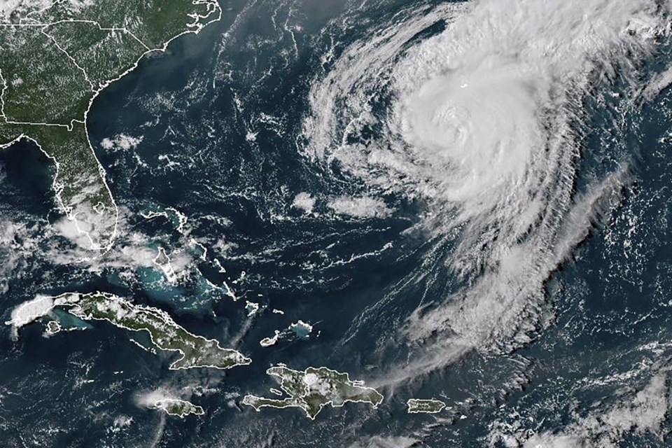
The storm made landfall in Bermuda earlier in the day, and its centre is now just north of the island.
"Ernesto will continue moving slowly northward today and will track well southeast of the Maritimes on Monday," said a statement from the weather agency. "It will bring heavy surf to Atlantic coastal Nova Scotia starting (late Saturday) continuing through Monday, with possible rain, wind and large waves for southeast Newfoundland later on Monday."
Hurricane Ernesto was being felt this weekend along much of the United States' Eastern Seaboard, even with the storm hundreds of miles offshore and crossing Bermuda. Dangerous rip currents forced some public beaches to close during one of the final busy weekends of the summer season.
The Canadian Hurricane Centre's statement noted there was a risk of rip currents for Nova Scotia on Sunday and Monday.
Parts of the province could also see rain but that could be from a tropical airmass and not Ernesto, it added.
"The centre of the storm will track well south of Nova Scotia."
Hurricane specialist Philippe Papin from the National Hurricane Center said Ernesto remains a “pretty large” hurricane with a "large footprint of seas and waves" affecting the central Florida Atlantic coastline all the way north to Long Island in New York.
Ernesto will transition to a post-tropical storm as it moves south of Newfoundland's Avalon Peninsula late Monday, said the Canadian Hurricane Centre.
Forecasters said it may pass close enough to bring some rain and wind to portions of the Avalon, Bonavista and Burin peninsulas, with the heaviest downpours expected to take place within a three-to-six-hour window.
"As Ernesto passes south or near the Avalon -- likely later Monday -- a short period of heavy rain is possible but it is a bit too early to speculate how much," it said.
The centre said large breaking waves will create a risk of some coastal flooding for communities on the southern Avalon Peninsula and Placentia Bay, and there could be some minor damage to docks and coastal structures.
"The windiest part of the storm is to the south of its track. The expected timeframe for this is later Monday," the statement said. "This will become clearer over the weekend and it is important to check weather forecast updates in case the storm tracks farther north."
-- With files from The Associated Press.
This report by The Canadian Press was first published Aug. 17, 2024.
The Canadian Press


