
A state of emergency has been declared in the Cowichan Valley due to widespread flooding that closed several roads, including the Trans-Canada Highway.
The Cowichan Valley Regional District declared a state of local emergency on Saturday morning.
UPDATE - The state of local emergency in the Cowichan Valley continues this morning, but water flows in several of the key watersheds in the region appear to have stabilized. For more information: https://t.co/hvK7UiX0zd
— myCVRD (@mycvrd) February 1, 2020
Twenty-three people were moved to safety on Friday night. Some were able to stay with family and friends, while others spent the night at the emergency reception centre at the Cowichan Community Centre for any affected residents.
The CVRD encourages residents in affected areas who require emergency evacuation assistance to call 911. The district will be posting updates on its website.
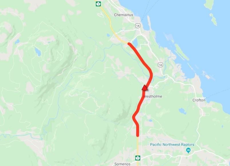
The Trans-Canada Highway near Duncan was closed in both directions for several hours due to flooding. The highway between Duncan and Chemainus reopened about 10:40 a.m.
#BCHwy1 the road is now fully OPEN between #Duncan and #Chemainus after flooding has been cleared up. Please expect delays.#VanIsle
— DriveBC VI (@DriveBC_VI) February 1, 2020
Other roads closures include Westholme Road, Chemainus Road, Canada Avenue, Mary Street, Tzouhalem Road. Check the Drive B.C. website for the most up-to-date information.
In Greater Victoria, there was single lane, alternating traffic in the northbound lane of the Trans-Canada at McKenzie Avenue. One southbound lane is open.
UPDATE - #BCHwy1 NB OPEN to single lane alternating traffic at #MacKenzieAve in #Saanich due to flooding. SB is open with one lane. Detour via bus route next to highway. Next update 12pm. #VictoriaBC #VanIsle
— DriveBC VI (@DriveBC_VI) February 1, 2020
For more info: https://t.co/nPdxfc4mBY
Environment Canada pinned the problem on an atmospheric river of subtropical moisture from the Pacific, bringing rainfall totals ranging from 60 to 120 millimetres for Vancouver Island, Metro Vancouver, the Fraser Valley and up the Howe Sound to Whistler.
The River Forecast Centre has issued flood watches, warning that rivers and streams could exceed their banks in southern and western Vancouver Island, Metro Vancouver and the Fraser Valley.
Flood Warning issued for South & West Vancouver Island. Flood Watch issued for Eastern Vancouver Island. More details at: https://t.co/ooqrQmg9DD #BCFlood #BCStorm
— Emergency Info BC (@EmergencyInfoBC) February 1, 2020
— With a file from The Canadian Press
Read more from the Times Colonist
