
Nearly half the landslides that rocked southwest British Columbia during devastating 2021 floods started in areas that were logged or burned by wildfire, researchers have found.
The study, published in the journal Earth Surface Processes and Landforms, analyzed more than 1,300 debris flows and landslides across 70,000 square kilometres of mountainous area flooded when a powerful atmospheric river slammed into B.C. in November 2021.
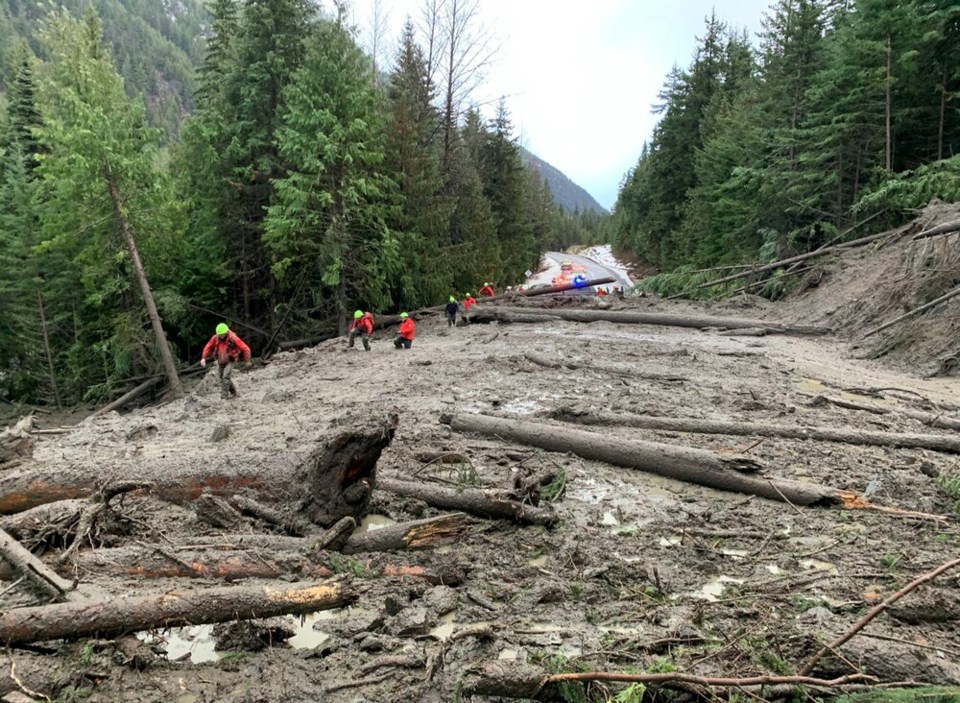
Roughly 18,000 people had to be evacuated as flooding and collapsing hillsides knocked out rail lines and highways.
Hundreds of people were stranded and six people killed — five in a landslide on Duffey Lake Road, and one when a bank collapsed, destroying a house.
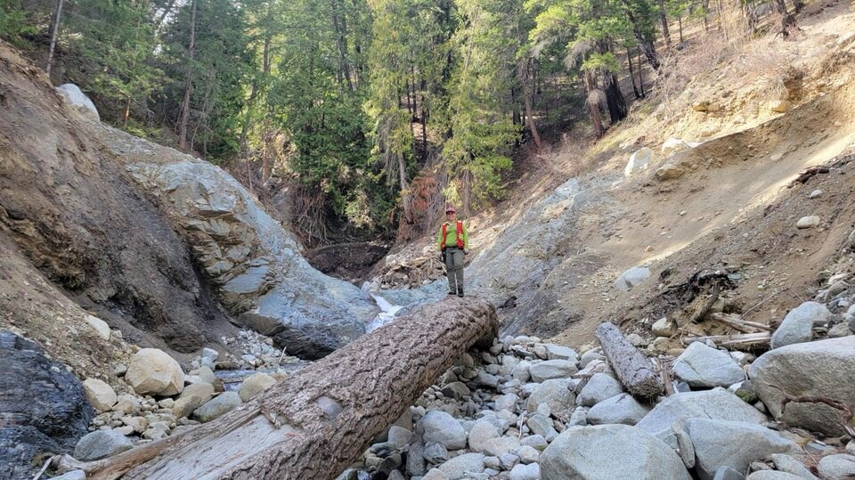
Carie-Ann Hancock, who co-authored the study as a senior geoscientist at BGC Engineering Inc., said she began collecting data for the study four years ago when she flew in some initial helicopter surveys.
“I was standing on the river bank and there were boulders bigger than me that moved down that channel to the river,” said Hancock. “I remember thinking, ‘How is that even possible?’”
At the time, First Nations that Hancock was working with in the Fraser Canyon began asking her why their communities were so devastated. Some questioned whether wildfires and logging had played a role.
As her database grew, the researcher would add more ground observations, social-media posts and on-site photography across southern Vancouver Island and coastal southwest B.C. as far inland as Pemberton, Lillooet, Merritt and Princeton.
To understand what happened in 2021, Hancock started digging into historical fire and logging records.
She found about 3,200 wildfires had hit the region since 1918. But in the 20 years leading up to the 2021 atmospheric river, those fires had grown in frequency and size.
That year, a heat dome set an all-time Canadian temperature record of more than 50 C in Lytton. A day later, a wildfire burned much of the town. Elsewhere in the province, persistent drought made more likely by climate change contributed to the burning of 8,700 square kilometres of forest.
Hancock calculated that since 1990, forest harvesting within the study area had removed approximately 4,000 square kilometres of forest cover. Another 3,600 square kilometres of forest had been cut in the 90 years prior to that, according to government figures.
In some cases, only 20 per cent of trees were left standing in sensitive areas, past studies had found. Harvesting all those trees required road access. In the region Hancock and her colleague looked at, they tallied 35,000 kilometres of mapped resources roads.
“I started to notice these patterns,” said Hancock.
More than 600 landslides started in burned or logged areas
When they finally published their study, the results showed landslides occurred more frequently downstream of logging roads and areas burned by wildfire. Freed from the roots of trees, hillsides collapsed, allowing sediment to pour into rivers.
Of the 1,300 landslides and debris flows that hit the region during the 2021 floods, more than 600 — 46 per cent of the total — were found to originate in disturbed forests.
Almost a third of those started in areas disturbed by logging cutblocks (15 per cent) or resource roads (14 per cent). Another 17 per cent started in areas hit by wildfire.
Light detection and ranging mapping (LiDAR), which uses lasers to map terrain, started to paint a more detailed picture in the Coquihalla and Coldwater rivers — both of which were responsible for significant flood damage to major highways, bridges and the City of Merritt.
At some places along the rivers, landslides originating in burned or logged areas were dumping a “conveyor belt” of sediment into the water at a rate of 50,000 cubic metres per kilometre — equivalent to 20 Olympic-sized swimming pools, said Hancock.
“That’s an extreme amount, and it has to go somewhere,” she said.
Landslides lead to long-term 'knock-on effects'
The more sand and silt poured into the rivers, the more the river ate into its banks. The result, found the researchers, were much wider and shallower channels in places like the Nicola River.
Shallow water heats up faster, and combined with drought, that’s resulting in “knock-on effects” such as decreased salmon returns years later, Hancock says.
Alila Younes, a professor at the University of British Columbia’s Department of Forest Resources Management, said the study appears to confirm that fallout from the November 2021 flooding cannot solely be blamed on climate change.
Data from the event, he said, shows human actions on forests — including clearcut logging and wildfires — increase the risk of flooding and landslides.
“This study corroborates the findings of my research over the last two decades that the watersheds across all of B.C. are already [at] a very heightened risk to geohazards as a result of clearcut and excessive clearcutting all over the province,” added Younes.
The researcher, who wasn’t involved in the latest study, said it’s time for the B.C. government to create a “paradigm shift” in the way it manages forests to protect downstream communities, infrastructure, fish and water quality.
2021 tragedy could repeat itself: researcher
The study did not take a close look at the Duffey Lake Road landslide that killed five people, as BGC Engineering has been involved as expert witnesses in ongoing litigation.
A proposed class-action lawsuit — filed on behalf of the surviving young daughter of a couple killed in the slide — claims the province failed to permanently deactivate the old road above the slide. A certification hearing is set to be heard in Vancouver next month.
As victims of the 2021 floods still seek justice, Hancock says the public should be putting pressure on policymakers to do more to prevent future tragedies.
Climate change is forecast to make extreme weather events more frequent and more powerful.
Past studies estimate powerful heat waves could return every five to 10 years over the coming decades. That is likely to set tinder-dry conditions for bigger, more frequent wildfires.
Atmospheric rivers, meanwhile, are expected to hit B.C. five times a year by the 2080s, up from less than once a year in the 1990s. By the end of the century, some have forecasted flood flows will be 40 per cent bigger than what’s currently expected, said Hancock.
“What a lot of people don’t realize is there were also resource road failures on the Coquihalla Highway,” she said.
“We have these resource road failures happening all over the province, but also in populated corridors where we have thousands of cars going through every day.”


