
Vancouver's had a few important decades as far as growth goes.
The 1980s saw Expo 86 and the resulting buildings, along with a big bump in population. The 2000s, leading up to the Olympics saw major changes in Vancouver, too, though not as many people.
A time of growth
In the 1930s the city saw a lot of growth and the addition of a few major icons to the city: the Marine Building, Hotel Vancouver (the third and current edition) Lions Gate Bridge, and the Burrard Bridge. Each was a sign of the city's status as they were grand projects of a huge scale for Western Canada; even now the Lions Gate Bridge is one of Canada's longest, busiest and biggest bridges.
However, the city was nothing like it is now. The metro Vancouver region was only about 348,000 people in 1931 - that's smaller than Victoria is now.
And the region wasn't as connected as it is at present; Vancouver was a separate city from the neighbouring communities, instead of it all blending as it does now.
The city's population itself was under 250,000, but that was a massive jump from the 115,000 or so in 1920. The population growth never quite matched that of the 1920s again, but Vancouver was still growing fast well into the 1950s. Between 1921 and 1951, the city gained 230,000 people. For context, between 1991 and 2021, Vancouver grew by about 190,000.
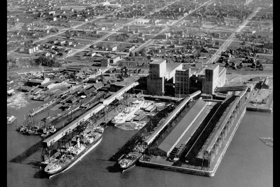
The harbour as a transportation hub
The aerial photos, taken in 1930 and 1931, are mostly of the city's downtown peninsula and harbour.
Throughout Vancouver's history, the harbour has played a significant role. In the 1930s it was a major transportation hub, not just for goods, but for people, too.
Air travel was still pretty new in the 1930s. Ships were the only way for most people to get from one side of the Pacific to the other, and rail was the most popular way to get across North America. Vancouver Harbour was where the ships and rail met.
For example, Babe Ruth, Lou Gehrig and others travelled to Japan for a big baseball exhibition tour in 1934. Vancouver was a major stop for them, as the New York Yankees travelled across the U.S. by train and to Japan aboard the "Empress of Japan"
Railways lined the harbour with several piers sticking out into the sea.
Changes
The photos also show how Coal Harbour has changed over the years. Positioned between Stanley Park and downtown Vancouver, it was near the industrial activity of the harbour and mostly made up of warehouses or residences. At the time some of the apartments, like the Felix Apartments were imposing structures for the area, among the tallest buildings in the community with views unobscured by trees or almost anything else.
Now, with the industrial activity just a memory and residential towers all over the place the Felix, the Stadacona and others look tiny and hidden by old trees.
One place that has barely changed over the decades, though, is Brockton Point. The lighthouse was built in 1914, and while Stanley Park's iconic seawall wasn't really in place in the 1930s, there was a section in place at the point. And Stanley Park Drive had been around for years, a regular route for cyclists and drivers.
Therefore, the photo (Slide 10) of the point taken circa 1931 actually looks fairly similar to the current site, with the big trees being the biggest change...as long as you ignore the skyline in the background.


