The intersection of West Hastings and Seymour streets in Vancouver is a place of huge buildings.
The Harbour Centre dominates the four corners, and other towering buildings surround the area. If you look northeast, it's just solid city, full of concrete and glass.
Over 130 years ago, when the city of Vancouver was founded, that wasn't the case. And while that's not a surprise, what may be a surprise is how far the city was from where it is now.
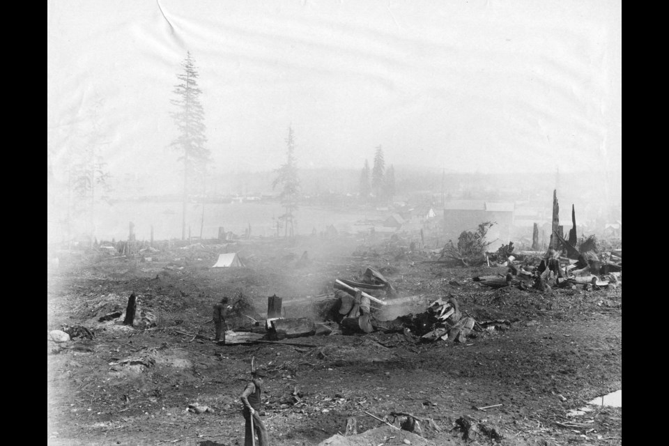
This photo shows the land being cleared at that same intersection. At the time the town hadn't moved east from Gastown yet, and so the only nearby 'structure' is what appears to be a canvas tent.
The rest of the foreground is dirt or the last remnants of the forest that stood before the city.
While the photo is dated 1886, the exact date is unknown in the City of Vancouver archives. However, it appears it was likely shot in the first half of 1886, as the Great Fire swept through the town on June 13.
In the background of this photo (and somewhat enhanced in one of the subsequent detailed shots in our gallery) the town can be seen, with dozens and dozens of wooden structures. As the fire ripped through the townsite levelling almost all the buildings, it's likely this photo was taken before the devastation.
It could be from after, as they did rebuild the town fairly quickly, but the fire would have also destroyed the trees and wood lying around the area.
In fact, this photo shows the activity that led to the Great Fire of 1886. People were trying to clear land for the settler city to grow, and fire was the best tool they had for getting rid what they considered waste wood, but it got out of control and destroyed the city in under an hour. In the other zoomed-in image, it appears smoke is coming off a charred log


