Smoke from forest fires and an early morning blaze (Sept. 10) has left some regions with "unhealthy" air quality.
Live maps show that air quality around Metro Vancouver is ranging between indexes of 5 and 10, or between "moderate" and "very high."
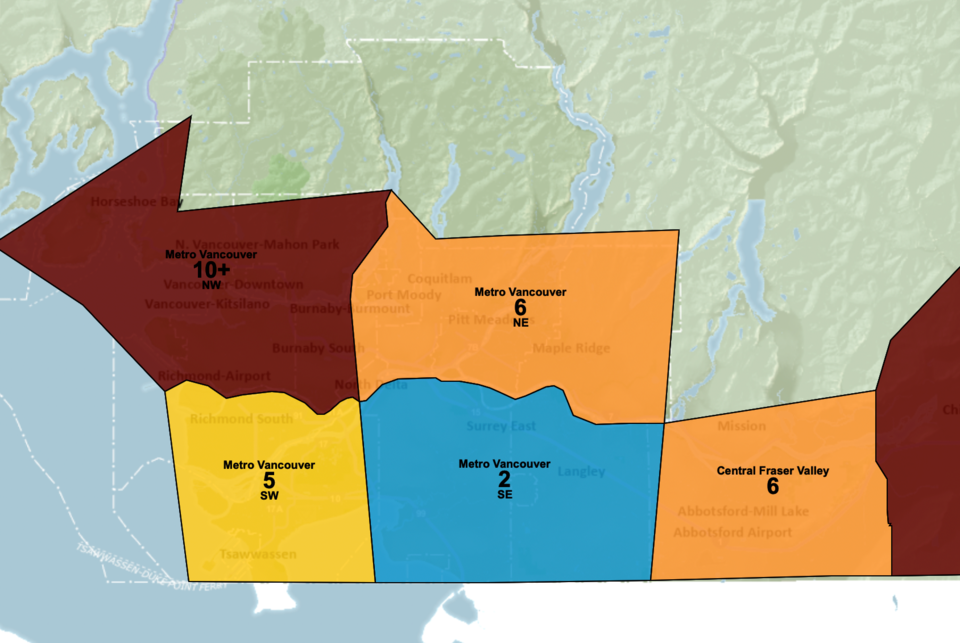
B.C.'s real-time air quality and weather map for the Lower Fraser Valley, AirMap, shows that the region encompassing Vancouver from north of YVR airport and west of Burnaby has an air quality index of "10+" or "very high."
East of Vancouver, spanning across the tri-cities, Pitt Meadows, and New Westminster, shows the next highest air quality index of 6, which is just short of "high." South of Vancouver, including Richmond South and Tsawassen, shows an index of 5.
Another live map for Metro Vancouver shows "moderate" air quality indexes across Metro Vancouver, and only one "unhealthy" air quality index in Burnaby South.
"My neighbourhood in [South Burnaby] smells really bad this morning and we can feel it a bit in our eyes. Stay safe out there people," said one resident on Twitter.


