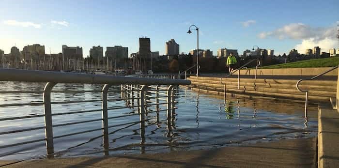
 KevinCGriffin / Instagram
A king tide has visited Metro Vancouver shores every day this week and brought with it some extraordinarily high sea levels.
While it has produced some particularly intriguing photos, officials warn that the rising tides are indicative of what Vancouver will look like in the future as a result of global warning.
In fact, the City of Vancouver is imploring residents to take photos in designated spots when the sea levels reach their highest points during the phenomenon. Since the announcement, a number of residents have posted images of the high tides on Twitter.
The Vancouver Park Board also tweeted some images of the occurrence, and shared an image of the Kitsilano pool next to the seawall. Underneath the photo they remark, "seawall next to pool temporarily closed until the tide ebbs."
Similarly, a resident tweeted an image of "water lapping onto the walkway on False Creek between David Lam Park and the foot of Davie."
Evidently, the royal tide isn't anything to mess with; the high waters provide a cautionary tale of how climate change may directly affect city shores.
https://twitter.com/White_K8/status/1067462470036418560
https://twitter.com/DrJohnCart/status/1067478975599898625
https://twitter.com/ParkBoard/status/1067511131940352000
https://twitter.com/ParkBoard/status/1067538709992468480
https://twitter.com/VPDMarineUnit/status/1067470707406204928
https://twitter.com/KevinCGriffin/status/1067479164188545024
Vancouver King Tide Remaining dates
Snap shoreline photos at our highest tides and help the city validate flood data. The rest of 2018’s King Tides are highest on:
- Nov 28, 10:18am
- Nov 29 11:10am
- Nov 30 11:59am
Find out more information about the tides and where to take photos on the Vancouver Sea Level Rise Story Map.


