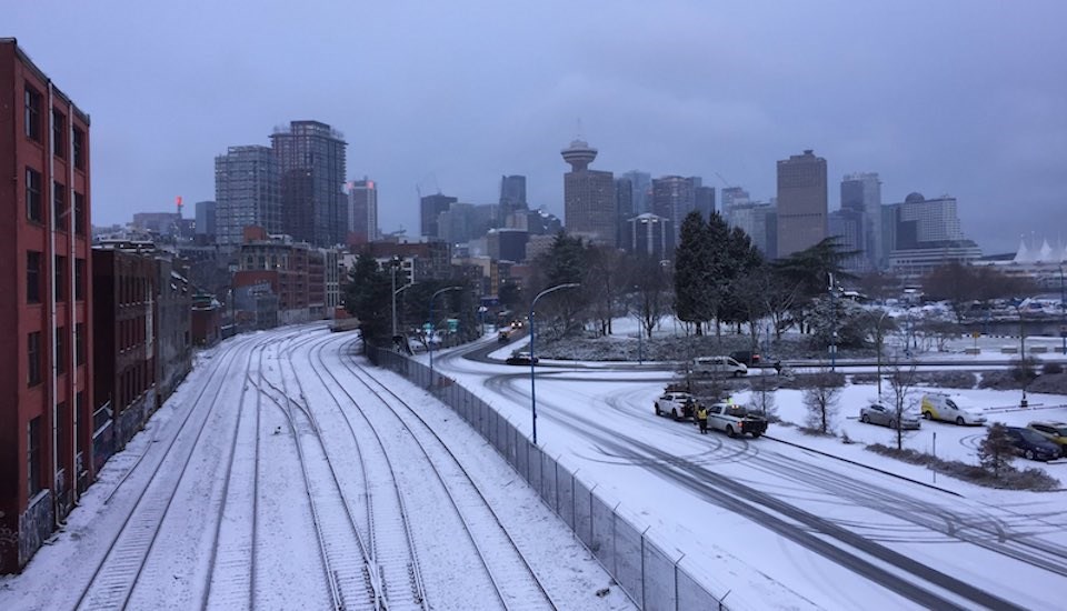
After two brutal snowstorms brought Vancouver's transportation network to a grinding halt over the holidays, locals may have felt somewhat unnerved to wake up to another dusting of snowfall Tuesday (Jan. 31) morning.
Although the white stuff is expected to persist on and off throughout the day, Environment Canada isn't calling for a significant amount of it to stick.
The flurries were expected to end sometime Tuesday morning followed by cloudy skies with a 40 percent chance of rain showers or wet flurries. A few rain showers and wet flurries are also expected to commence later in the evening with a low of 1 C expected overnight.
The national weather forecaster hasn't included the possibility of more flurries for the remainder of the week, with a warmer, wet pattern replacing the frigid spell. Temperatures are expected to warm up Wednesday, with a high of 5 C forecasted during the day and temperatures expected to dip down to 2 C overnight.
Thursday's forecast includes rain and milder weather, as temperatures are expected to climb a couple of degrees up to 7 C during the day and down to 6 C overnight.
Similar temperatures and wet weather are forecasted heading into and through the weekend, too.
Metro Vancouver weather forecast includes flurries and cold temperatures
Locals took to social media to share images of the city covered in a fresh dusting of powdery snowfall. Many of them commented that the ropes were somewhat slippery, while others remarked that they were "surprised" to see the wintry scene.
Several people noted, however, that this snow event is more of a "light dusting" and pales in comparison to the potent snowstorms that wreaked havoc on the region in December.
Vancouver today, and Kyiv today. pic.twitter.com/PoHvou0wj4
— Peter Vogel (@PeterVogel) January 31, 2023
Downtown #Vancouver #BC side streets a little slippery but manageable - 740a #ShareYourWeather #YVR #YVRwx #BCwx #BCstorm pic.twitter.com/Nm6ramG1lg
— Ryan Voutilainen 🇨🇦🇫🇮🇺🇦 (@RyanVoutilainen) January 31, 2023
Surprised when I left my parkade sleeping spot to see snow! Security guard doing rounds of a Sleep Country told me it was way heavier on SW Marine, where they'd driven from. Only 0°C but felt colder. Glad warming centre at 1443 W 8 was open for #homeless last night! #Vancouver pic.twitter.com/R5XhGIL9Wb
— Stanley Q Woodvine (@sqwabb) January 31, 2023
Light snow falling in downtown #Vancouver #BC… no more than a couple of centimetres expected but enuf to give ppl a fright & mess with the AM commute. ❄️ https://t.co/2HGpsiBhx0
— Ryan Voutilainen 🇨🇦🇫🇮🇺🇦 (@RyanVoutilainen) January 31, 2023
A very light dusting.
— Val C. (@vcinbc) January 31, 2023
Pendrell St. Vancouver
07:40, 2023-01-31#bcstorm #WestEndlife pic.twitter.com/wH9vgRAKLN
Even after a really Snowy November and December 2022. These are our first Snowflakes of 2023 in Vancouver, BC this morning. #BCStorm #ShareYourWeather @spann @weathernetwork pic.twitter.com/bLNbF4Ivd1
— Brad Atchison (@Brad604) January 31, 2023
While Environment Canada's models can estimate general patterns in the long-term Metro Vancouver weather forecast, weather anomalies, such as Arctic air, can only be predicted about seven to 10 days out.
But this doesn't mean that the region couldn't see another cold spell in February -- or even in March. That said, the possibility of ultra-cold temperatures lessens heading into March, as longer days warm temperatures up.
The national weather forecaster is calling for below-average temperatures in February but there is always some fluctuation in the month.


