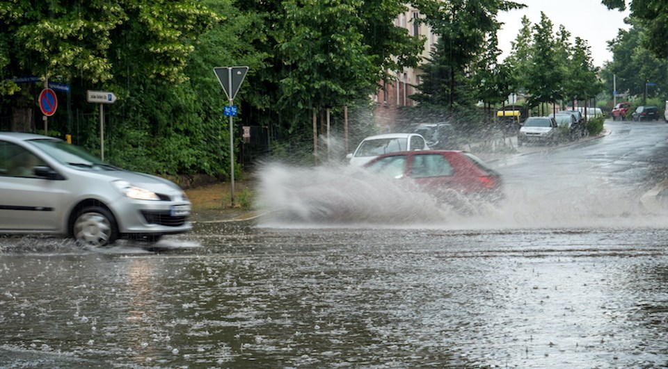
A rainfall warning is in effect for Metro Vancouver as an atmospheric river brings heavy rain and strong winds to the region.
Environment Canada calls for total rainfall amounts of 50 to 70 mm on Friday (Nov. 4) with the highest amounts over higher terrain.
Heavy downpours can cause flash floods and water pooling on roads. Vancouver Police say officers have been busy with collisions Friday morning and remind drivers to slow down and "drive for the conditions."
Localized flooding in low-lying areas is also possible and "landslides may occur in vulnerable areas such as steep slopes," according to the special weather statement.
The heavy rainfall is expected to taper off to showers this afternoon.
Vancouver weather includes more rain this weekend
Locals have taken to social media to share images of the gloomy weather in the city, complete with heavy rainfall and scores of umbrellas.
Stanley Park seawall day off work walk. Wet one. Downtown #Vancouver #Exercise #ShareYourWeather pic.twitter.com/wKayP813LK
— Stephen A. Braverman (@stephenbraverm1) November 4, 2022
This is what it takes to apply for a 🇨🇦passport. 6:30am in the rain and ppl are already waiting. Better bring your own chair and take a day off cuz it’ll be a long wait! Just embarrassing #TrudeauworstPMever pic.twitter.com/FrDC5W1Ssw
— Han Yang (@HanYang_VFX) November 4, 2022
Metro Vancouverites also shared videos and pictures of the first snowfall in many parts of the region at higher elevations late Thursday night.
Winter has begun. Let it snow ❄️ #Vancouver pic.twitter.com/TbCeGw50vV
— AP 🤘 (@Aslampatel) November 4, 2022
Step into the third night of November 2022, which still autumn season, we got first snow fall tonight 🍁🍂 at Burnaby Mountain #firstsnowfall #snowing #burnaby #burnabymountain pic.twitter.com/mfcbL45WYv
— Melissa 🇨🇦 (@puffinvan) November 4, 2022
Step into the third night of November 2022, which still autumn season, we got first snow fall tonight 🍁🍂 #firstsnowfall #snowing #burnaby #burnabymountain pic.twitter.com/taHDa3IxW2
— Melissa 🇨🇦 (@puffinvan) November 4, 2022
Your eyes aren’t playing tricks on you #Vancouver - a few #snow flakes mixed in with the “chunky rain” over the city’s higher hills. This taken at W 37 & Oak at 5:43p PT#ShareYourWeather #BCstorm #WinterIsComing @ensembleator @50ShadesofVan @weathernetwork pic.twitter.com/fxGJFQ1AAZ
— Ryan Voutilainen 🇨🇦🇫🇮🇺🇦 (@RyanVoutilainen) November 4, 2022
The North Shore Mountains had a great deal of "soft and fluffy" snow thanks to the atmospheric river, too.
Not bad Snow quality for November 3rd on our North Shore Mountains. Quite soft and fluffy on Mt. Seymour. @50ShadesofVan @ensembleator #BCStorm pic.twitter.com/rts1nI4yGi
— Brad Atchison (@Brad604) November 4, 2022
Looking ahead to the winter season, the long-term forecast isn't clear. While there is a seasonal forecast for the next three months that includes October, November, and December, the first half of October's unseasonably hot weather has skewed the average.
In a recent update, the National Oceanic and Atmospheric Administration (NOAA) called for a 75 per cent chance that La Niña will be present this winter and won't change to a "neutral" weather pattern until about February.
Typically, La Niña's impact on southern B.C. doesn't start to show until the late fall or early winter. But it does tend to produce cooler than normal conditions and snowier conditions over the mountains.


