
Environment Canada advises British Columbians to brace for dangerous travel conditions as a powerful storm batters the coast starting on Monday, Dec. 4.
The Metro Vancouver weather forecast also includes a rainfall warning as an atmospheric river drenches the region with a projected 50 to 70 mm of rainfall starting Monday and continuing through Tuesday.
Environment Canada Meteorologist Armel Castellan told V.I.A. in a previous interview that most atmospheric rivers aren't harmful weather events and keep local ecosystems healthy. They also aren't rare, with the Lower Mainland seeing anywhere from 20 to 30 of them annually.
The Center for Western Weather and Water Extremes (CW3E) uses a scale to measure the impact of atmospheric rivers, including its intensity (the amount of rainfall it will produce) and its duration (the length of time that it will impact an area). The system rates the weather events from AR (atmospheric river)1 through AR5, with the first being "primarily beneficial."
Castellan said Monday's atmospheric river would be mostly beneficial, bringing much-needed precipitation to parched B.C. soil; most parts of the province received a mere 40 to 50 per cent of its regular rainfall amounts in November.
In a report released Sunday, The Weather Network clarified that the weather event would be an AR1 to AR2, meaning that it would either be "primarily beneficial" or possibly "mostly beneficial, also hazardous," based on the CW3E rating scale.
Metro Vancouver weather forecast: What to expect during the atmospheric river
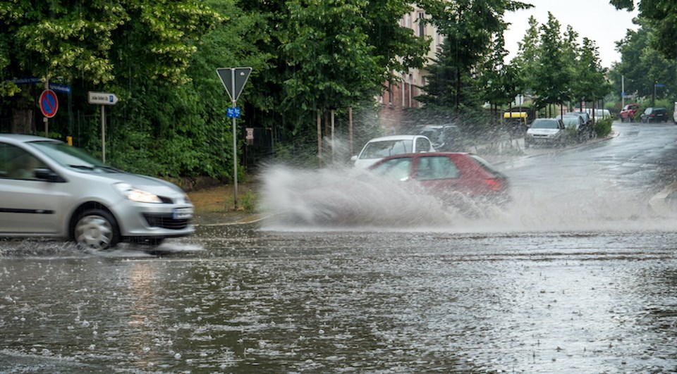
Combined heavy rainfall and soaring freezing levels will increase the threat of localized flooding in many areas across the Lower Mainland and alpine regions will see an increased avalanche risk "as warm temperatures and the rain destabilize the fresh snowpack," according to The Weather Network.
Drivers are also warned about hazardous travel conditions due to localized flooding and poor visibility due to heavy rainfall and wind across the Lower Mainland.
Environment Canada also issued highway alerts for the Sea-to-Sky Highway north of Metro Vancouver into Squamish and Whistler, as light snow is expected to transition to heavy rain over the mountain passes. Similarly, in the B.C. interior, the Coquihalla may see rainfall amounts exceeding 60 mm overnight.
Power outages are also possible in Metro Vancouver throughout the storm due to strong winds.
This atmospheric river is a "pineapple express"
B.C. is being impacted by a classic "Pineapple Express," which is a type of atmospheric river that originates near the Hawaiian Islands and brings tropical moisture to the Pacific Coast, according to the Weather Network.
These weather patterns bring heavy rainfall to the Lower Mainland and result in "tremendous snows along the mountain peaks."
By Monday afternoon, rainfall rates should reach 10 to 15 mm per hour as the storm impacts the region.
The Pineapple Express will also bring strong winds to the region, although a wind warning is not in effect. That said, there may be issues with ferries as winds gusting up to 50 km/ h pick up Monday evening.
The western side of Vancouver Island will bear the brunt of the storm, with rainfall totals of up to 100 mm in places like Tofino.
In contrast, neighbourhoods across Metro Vancouver are expected to see anywhere from 30 to 50 mm of rainfall while places in the Fraser Valley could see up to 75 mm.
V.I.A.'s Weatherhood shows varying precipitation amounts for neighbourhoods across the Lower Mainland. It has up-to-date information about the current conditions and expected changes broken on 6-, 12-, and 24-hour periods for over 50 places across the region.
Will it snow in Vancouver this week?
While several places across the province received snowfall last week, the City of Vancouver isn't likely to see any of the white stuff. That said, there is currently a possibility for rain showers or flurries overnight Friday as temperatures fall just above the freezing mark overnight.
The flurries would be more of a "mixed precipitation" and would not accumulate on the ground.
While the next couple of weeks are uncertain, Environment Canada expects the Lower Mainland, as well as the rest of B.C., will see a warmer-than-average winter.
Following three chilly La Niña years, El Niño is expected to break the cold run by bringing milder temperatures to the region.


