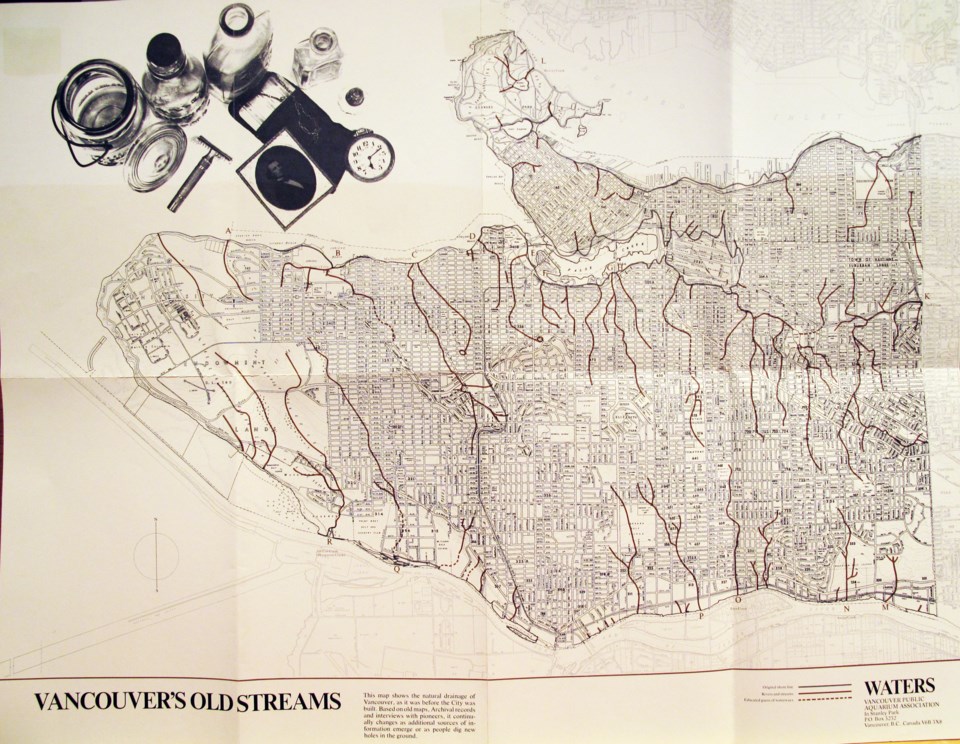
When I'm walking in the rain on dirt trails in the Lower Mainland, I tend to get this sense that I'm not so much stepping on wet dirt, but that I'm barely avoiding sinking into water that's really full of dirt. And though I grew up in a ditch-encrusted neighbourhood next to a ravine, I never considered that other streams had been buried by the development of our cities.

Of course, there are tons of salmon runs and spawning streams that branch out from the ocean around here -- so why did it never occur to me (until I was reading a history book) that Vancouver had active salmon spawning streams too?
If you click on the photograph above, which is of a poster of Vancouver's Old Streams I found in my grandparents' affairs, it will open a larger version that you can zoom in on. Note the area of low-lands devoid of streams near Chinatown, just east of Main Street and west of Clark -- the area was tidal flats before being filled in in the 1930s. My grandmother told me once that she and her brother would run across the flats at low tide from Strathcona to swipe apples from a backyard on the other side.

It just fascinates me to think of the waterways that still, one way or another, flow under us everyday. Sure, a lot of them have been diverted to storm sewers and gush out into the inlets and bays, but water has a long memory of where it wants to go.
So I'm excited to promote an unveiling tonight at Rhizome Cafe (317 E. Broadway) of the False Creek Watershed Society's community mapping project. Artists Wes Nahanee, Celia Brauer, Louise Towell, and historian Bruce Macdonald will present the artworks and new thoughts that came out of tapping into local knowledge. (More event info here)
As the project site for "The Water Beneath Our Feet" says:
The process of mapping has been done by humans through countless centuries. Maps of trails, feeding grounds and seashores have been prominent in history books. Maps were one of the first images made by the explorers of the New World. Using as a guide the award-winning model created by the BC artists and community leaders “Islands in the Salish Sea –a Community Atlas” [Heritage, 2005] http://www.heritagehouse.ca/press_releases/salishsea_press.htm we would like to share the idea of mapping one’s “home place” to the centre of Vancouver’s False Creek.
I'll just end this by saying one of my favourite discoveries in Vancouver has been Camosun Bog -- also the only place I've seen an owl in this city.
What's your favourite water feature in the city (and it's okay if it's not natural!) Tell us in your comments below.


